
22: Linking Technology and Nature Using GIS with Kevin Rohling
![Kevin_MSP_2021[2491].jpg](https://images.squarespace-cdn.com/content/v1/5f9ee29ff88f993263e78133/1633459308821-I0O0SS547SQQU4GLAH7R/Kevin_MSP_2021%5B2491%5D.jpg)
This week we chat with Kevin Rohling a Forester Research Technician. Kevin earned B.S. and M.S. degrees in Geography from Southern Illinois University Edwardsville, specializing in Biogeography and GIS. He conducts research focusing on invasive species issues, prescribed fire, use of technology in forestry, wildlife monitoring, chainsaw safety, natural areas management, and outreach and interpretation.
Topics we cover are:
What is GIS
How does it work
Why is it important?
How can this be used to monitor Climate Change?
Future Research that needs to be looked at using GIS
How to help flora and funga with technology
Herbicides and GIS monitoring
Find Kevin and resources mentioned below:
University of Illinois Extension Forestry Website:
University of Illinois Extension Forestry YouTube Channel:
Early Detection and Distribution Mapping System (EDDMapS, for invasive species reporting)
Follow my other social media sites to interact and engage with me:
floraandfungapodcast@gmail.com
Facebook
Instagram
Twitter
YouTube
Help support my book and tea buying habit by "Buying me a Book"
a twist on buy me a coffee
When I reach my goal of $100 I will do a special book giveaway!
Theme song :
-Soundotcom called Go Rock
-Take the Lead by Kevin MacLeod
Link: https://incompetech.filmmusic.io/song/4458-take-the-lead
License: http://creativecommons.org/
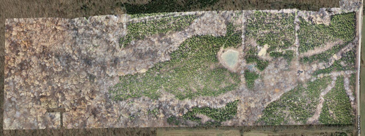
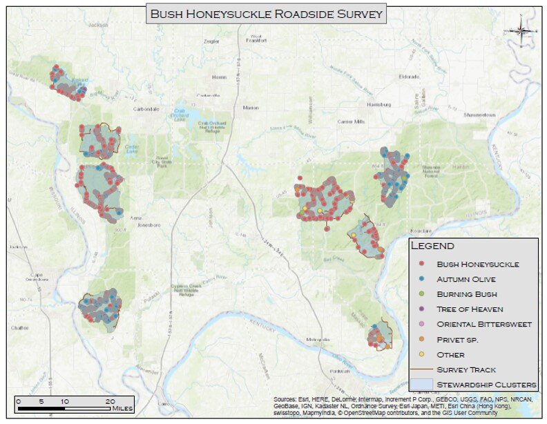
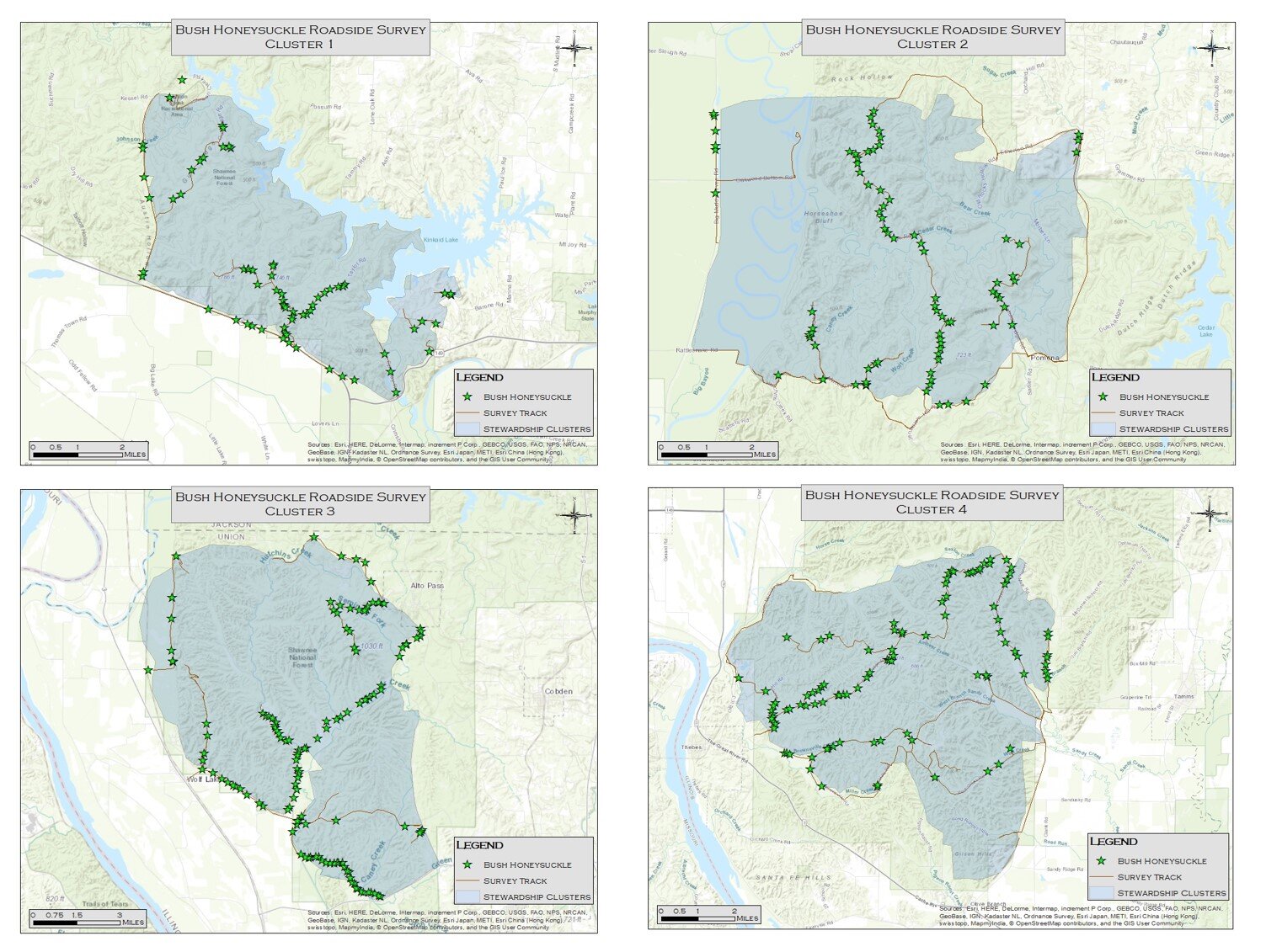
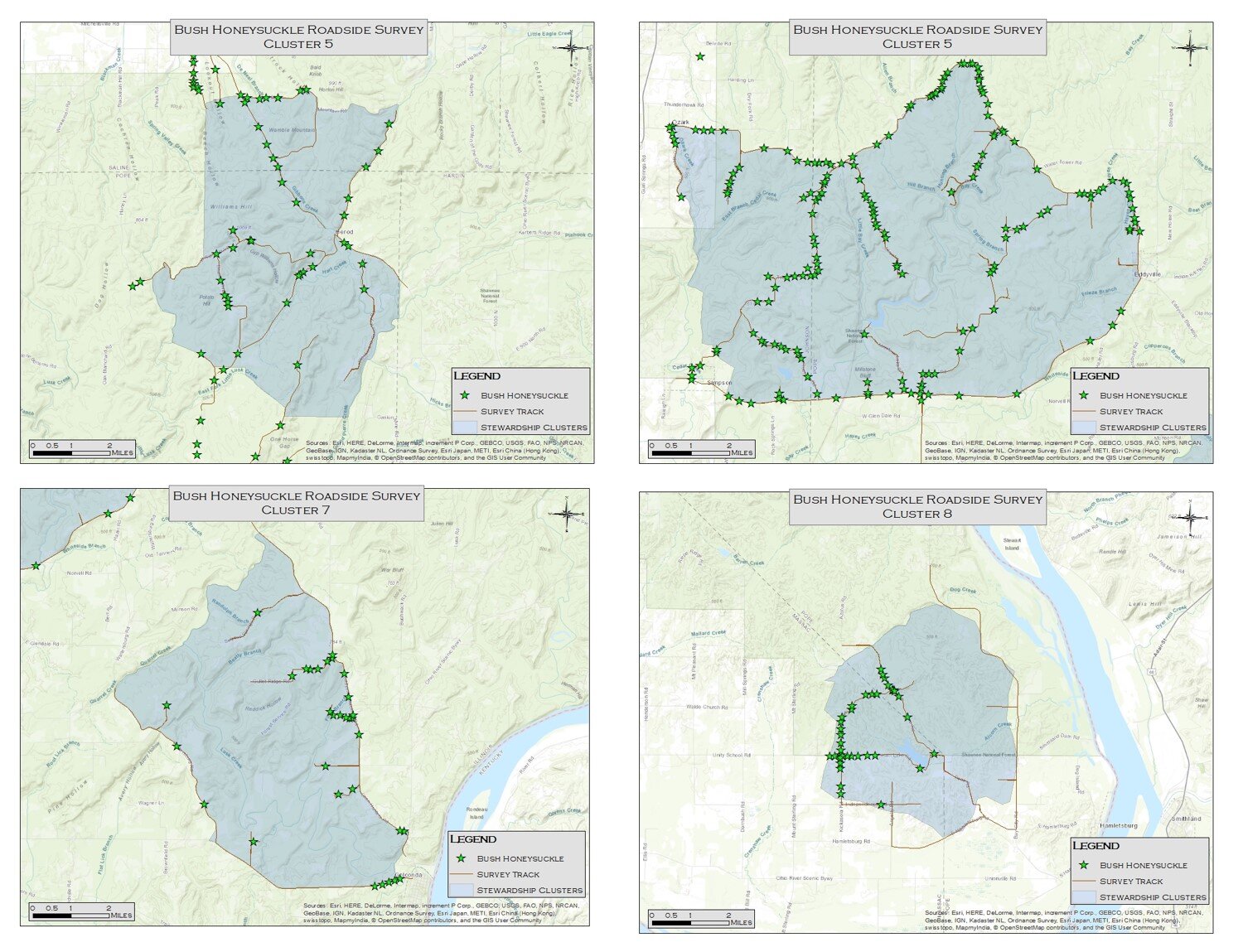
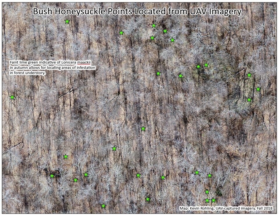
Images above are survey examples using GIS